Archive for the ‘Edmonton’ Category

Back to School: University Area

Monday, August 25th, 2014

It’s that time of year again.


With heads hung low, our young’uns are dragging their feet back for yet another year of schooling. For those of us with not-so-young’uns this might mean experiencing their first year of collage; some in a new city, or just a new part of the city trying to live life on their own. This is why the surrounding residential areas of the University of Alberta have become so desirable.


Aerial view of campus and surrounding neighbourhood. Image credit: University of Alberta

Aerial view of campus and surrounding neighbourhood. Image credit: University of Alberta


There are many tiers of residence options from condominiums to large family homes. Residences can be bought with the short-term goal of housing a son or daughter for the duration of their studies, and then flipping the investment for profit. It can be lived in by the family into the foreseeable future. Or any of these lucrative properties can be held on to, and rented out year after year for the throng of passing students always looking for temporary housing. The turnover of renters, and neighbourhood desirably  makes it equally easy to rent, sell, or live in the area.

This student turnover explains the high mobility of residents in the neighbourhood of Stratchcona. According to municipal census statistics, about 30% of residents had lived at the same address for 5 years or more, with 7 out of ten having moved within 3 years or less.


Row Housing near campus. Image Credit: University of Alberta

Row Housing near campus. Image Credit: University of Alberta


The area of residences near the University is considered to by part of the larger Edmonton neighbourhood, Strathcona. This historic area is quite old by Edmonton standards, around 15% of residences were built before 1946 and just over half were built in the 60’s and 70’s. This explains the eclectic architectural vibe of the neighbourhood and provides a wide array of housing options for interested potential residents. Around 44% of area homes are low rise apartment buildings, ideal for thrifty first years on campus. Approximately 24% of the area is comprised of single family dwellings, beautiful homes for the family or a comfortable, spacious retirement.


Saskatchewan Drive walking trail. Image Credit: University of Alberta

Saskatchewan Drive walking trail. Image Credit: University of Alberta


The University area’s desirability also has to do with it’s ample amenities. Designed as a neighbourhood for students with limited to access to their own transportation, almost every necessity is in walking distance, including grocery, restaurants, laundry, Edmonton’s popular Whyte Avenue district, multiple theatres, and of course all the buildings on campus. As well,  the University’s transit centre is a main hub for bus and LRT services to all access all parts of the city.

Click here to view properties in the University area. 

Community Profile: Sweet Grass, Ermineskin, and Bearspaw

Monday, May 19th, 2014

The communities of Sweet Grass, Ermineskin, and Bearspaw comprise a large part of Edmonton’s south. These areas are almost exclusively residential and include large expanses of green space. They all share convenient access to the major shopping areas of Southgate Centre, South Edmonton Common, as well as proximity to the new LRT extension.

Sweet Grass borders 34 Avenue to the north, and it’s southern border partially includes Saddleback road and runs along a utility corridor, while it’s east and west boundaries run from 111 Street to 119 Street.  The area was annexed to the City of Edmonton in 1964, and residential development occurred throughout the 1970’s and into the early 1980’s. The area is a blend of single-family-dwellings, row houses, and low rise apartments and the residences are a combination of owner occupied and rental properties.

Sweet Grass

Sweet Grass Park. Image Credit: Yegishome.ca

Like many other communities in Edmonton’s south-west, Sweet Grass is named to honour the rich aboriginal history of the area. Chief Sweet Grass was a Cree political leader and early environmentalist who was actively outspoken about protecting bison herds common to the region.

The neighborhood’s focus is the central elementary school, bordered by parkland and recreational areas.

CLICK HERE to view properties for sale in Sweet Grass

Ermineskin falls to the south-east of Sweet Grass, it’s northern border a utility corridor just south of Saddleback road while it’s south borders 23 Avenue. It runs from 111 Street in the west to Calgary trail in the East.

Major residential construction of Ermineskin occurred in the 1970’s into the 1980’s, however some residences can be dated back to just earlier than 1960 and also later than 1990. The area is comprised mainly of rental apartments, following by apartment style condominiums. The remainder of the area is comprised of single-family dwellings, row houses, and duplexes.

Ermineskin Craft Fair. Image Credit: Ermineskin Community League

Ermineskin Craft Fair. Image Credit: Ermineskin Community League

A prominent neighborhood feature is the former Heritage Mall development site, located on the western boundary of the neighborhood which began a major overhaul in the 2000’s. The location now know as “Century Park” encompasses commercial, office, and residential sites. The location also includes a central recreation area and the newest LRT station, Century Park.

This development and addition of green space has revitalized the area’s very active community league. The Ermineskin Community League hosts year-round events, fundraiser, and ongoing programs such as Zumba classes, pancake breakfasts,  rummage sales, quilting, hockey, scrap booking, and more.

CLICK HERE to view properties for sale in Ermineskin

Bearspaw lies a few communities south of Ermineskin, bordered by Blackmud Creek in the west to Calgary Trail, and from Anthony Henday Drive in the south it runs north until 18 Avenue. Bounded by these major thoroughfares, the community has convenient access to major commercial shopping in the south, as well as access the Edmonton International Airport and the University of Alberta.

Combined with it’s northern neighbor of Keheewin, the two areas comprise the Yellowbird East Community League. This community league organizes children’s athletics, as well as adult recreation, community events, and fundraisers for the two neighborhoods.

Bearspaw Lake

Bearspaw Lake. Image credit: Yegishome.ca

The area is conducive to outdoor recreation activity due to it’s proximity to Big Bear Park, a large hill with Blackmud Creek Ravine access to hiking, as well as a major greenbelt running along Bearspaw lake which the neighborhood centers around. Additionally, the William Lutsky Family YMCA is also located in the area, for indoor fitness and leisure access.

Bearspaw became a part of the city officially in 1974, however most development didn’t occur until the 1980’s when many of it’s single-family dwellings were constructed, though semi-detached and row houses can also be found. The area is predominantly owner-occupied, with only about a 9% rental rate.

CLICK HERE to view homes for sale in Bearspaw.


Community Profile: Royal Gardens, Greenfield, Duggan

Monday, May 5th, 2014

The communities of Royal Gardens, Greenfield, and Duggan comprise part of Edmonton’s Southwest, partially bordering the Whitemud Freeway.

Royal Gardens spans 119 Street to 111 Street, and south from Whitemud to 40th Avenue. Bordered by main thoroughfares, this almost exclusively residential community has some of the easiest access to shopping and and public transit in the city. Smaller shops are available in the neighbouring community of Greenfield, while the larger Southgate Centre (as well as the Southgate transit centre and LRT station) are just a stones throw away.

The area has been part of the city since 1912 when it was first dubbed “Royal Gardens”, however the historical significance of the name has seemingly been lost since. It wasn’t until the 1960’s that a push was made for residential development, when many of the area’s single family dwellings were built. The area also has a mix of apartments, apartment style condominiums, row houses, and duplexes; just under half the residences are rental properties.

Royal Gardens Winter Festival

Royal Gardens Winter Festival. Image Credit: Community League

The neighborhood has a tendency towards higher tenant mobility, yet this is contrasted with strong community involvement in this incredibly social neighbourhood. The hub of the community is the Royal Gardens Park, where the community league hosts a range of year round activities including an annual car rally, a winter carnival (with sleigh rides!), holiday parties, as well as children’s summer camps and recreation programs.


Click Here to view properties for sale in Royal Gardens

Sharing Royal Garden’s southernmost border of 40th avenue, is the community of Greenfield, which spans as far south as 34 Avenue, and runs from 119 Street to 111 Street. Though officially titled Greenfield, in honour of Alberta’s fourth premier Herbert Greenfield, the locals sometimes refer to the area colloquially as Petrolia; the small shopping area in the community also bears this name.

Greenfield Spray Park. Image Credit: Community League

Greenfield Spray Park. Image Credit: Community League

The family friendly area also has a very active community league, whose fundraising and lobby efforts led to the installation of a new spray park in 2009. Strong shinny, and soccer program keeps neighbourhood youth active and involved, while parents host and participate in yearly community events and fundraising efforts, such as bingo nights, fireworks, yoga, and tai chi classes.


A unique program of note is the community league’s Greenfield Scholarship. Two scholarships are awarded each year to post-secondary applicants living in Greenfield, in commemoration of former upstanding residents. This program was designed embody the community values of Greenfield locals.

Nearly all the residences are single family dwellings, with a handful of apartment complexes and duplexes comprising the remainder; the rental rate in the area is less than 10%.

 Click Here to view available properties in Greenfield.

Duggan falls on the East side of Greenfield, sharing a mutual border of 111 Street and carrying on until Calgary Trail. It’s northern border runs along 40th Avenue and goes south to 34 Avenue.

The community league has a full calendar of events on a nearly daily basis. Unique actives on the go include Bridge club, and weekly square-dancing. Duggan also has a large yearly Mother’s Day Soccer Tournament which focuses heavily on sportsmanship and participation. Here’s an exciting recap of last years events, and a great reiteration of Duggan’s community league values:

The neighbourhood is comprised of about sixty percent single family dwellings, with the remainder mostly apartment complexes and row houses; about half of these properties are owner occupied. Duggan has fairly low mobility rates, half of residents have resided in the area five years or more, and most cited no plans to move.

Click Here to view properties for sale in Duggan 


Community Profile: Patricia Heights, Rio Terrace, and Oleskiw

Monday, April 21st, 2014

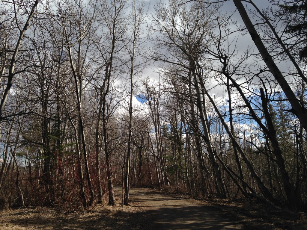
All three of these stunning communities overlook the North Saskatchewan River Valley, providing easy access to walking and biking trails. Additionally, limited vehicular access lends to an ambiance of peaceful seclusion.

Though still considered a mature Edmonton neighborhood, the community of Patricia Heights is comparatively young, having not officially joined the city until 1964. Bordered on the north by Whitemud Drive, and on the east by 156 Street, the rest of Patricia Height’s boundaries are formed naturally by the curvature of the Patricia Ravine.

Patricia Heights Patricia Heights Walking Trail Access

Named in honour of Queen Victoria’s granddaughter, the prominent area flourished in the late 1960’s, with it’s residential building projects entirely completed just a decade later. A mix of owner occupied and rental properties, approximately half the area is comprised of single-detached homes while the other half is made up of low and medium rise apartment buildings.

Families are attracted to the quiet, tight-knit community, with only two interchanges on 156 Street and on 159 Street to access Patricia Heights.

Adjoining the Eastern border of Patrica Heights, lies Rio Terrace, spanning from 156 Street to 149 Street, and Whitemud Drive down to the river valley. It shares many walking trails and green space features with Patricia Heights, as well as the same two access roads.

Construction on Rio Terrace started just a decade earlier in the 1950’s, and the entirety of neighborhood dwellings are single-family homes, approximately 20 percent of them rental properties. In 2010 the community underwent a major municipal revitalization. Renewals included roadway reclamation, streetlight upgrades, and sidewalk, curb, and gutter reconstruction.

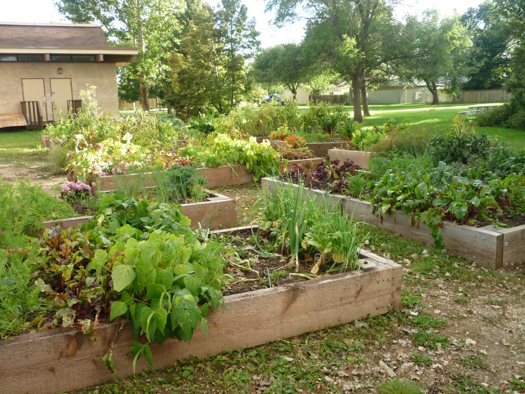
The most notable feature of Rio Terrace is it’s active community league and strong volunteer program. The Rio Terrace Moravian Church is heavily involved, hosting a performance series of musical artists. A strong soccer program attracts young families, while the “Rio Gardens! Community Garden” program facilitates a sustainable food initiative; an incredibly important community value.

Rio Gardens Rio Gardens sustainable food initiative.
Rounding out these river valley communities is the affluent area of Oleskiw. Bordered on the west side by 170 street, Oleskiw is pocketed in the river valley on all other sides.

Though development on the area began in the 1970’s, it wasn’t officially declared complete until 2000, making the properties an eclectic mix of many decades of architectural tastes. With 90 percent of properties single-family dwellings, a few row houses round out the area, which is an entirely owner occupied neighborhood.

Highlights of this private, yet trendy area include the Edmonton Country Club and Golf Course, Sorrentinos, Starbucks, and the Marketplace at Callingwood, which includes the city’s largest Sunday farmer’s market.

Homes in Oleskiw. Image Credit: Yeg Is Home Homes in Oleskiw. Image Credit: yegishome.ca

A notable geographic feature is the Oleskiw Treestand, a deciduous habitat for urban wildlife. Home to many birds and mammals, the treestand is included on many nature walks, and has been a protected area since 1978.

View available properties in: Patricia Heights, Rio Terrace, and Oleskiw.

Community Profile: Grovenor, North Glenora, and Glenora

Monday, April 14th, 2014

Diversity, ecology, proximity, family: these are the values cited by the extensive Grovenor community website . An unexpectedly old neighborhood, considering its relative distance from the city’s core, the original dwellings bordering the ravine were built around 1907. The community borders 149 Street to 142 Street on the east and west, and 107 Avenue south to the Mackinnon Ravine.

In the area’s extensive history it has changed names (formerly Westgrove) and spurred on by the railways passing through was almost completely industrial up until the 1940’s. Then a transformation began, completed in 1980, to an entirely residential community save a few bordering shops on it’s main thoroughfares.

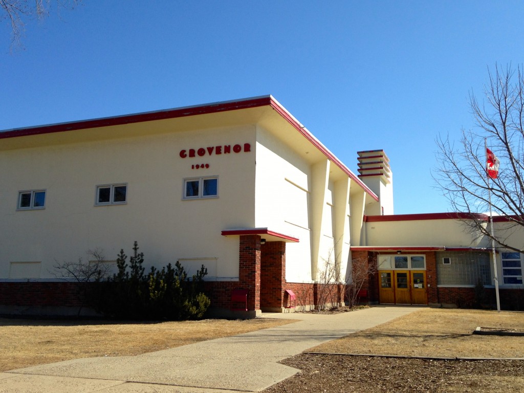
Grovenor School

Grovenor School

A tight knit community known for it’s elaborate Halloween houses, success in the sport of shinny, and it’s focus on family values, the community emphasizes the desirability of the area for raising children, noting it’s elementary school, historic church, and community league programs.

Bordering Grovenor to the east is the historic community of Glenora, which naturally falls just south of the community of North Glenora. Glenora extends from 142 Street to Groat Road and the River Vallery, and north until 107 Avenue. North Glenora resides on 107 Avenue to 111 Avenue and 142 Street to Groat Road.

It may not be surprising to learn that the area of Glenora was part of an 1860’s river lot owned by Malcolm Groat, namesake to much of the area’s landmarks and of course Groat Road, which at the time demarcated the outer city limits.

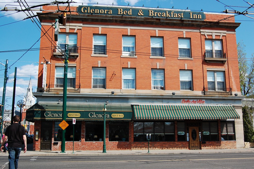
Glenora Bed & Breakfast. Image Credit: Darren Kirby

Glenora Bed & Breakfast. Image Credit: Darren Kirby

This sprawling riverside area is notable for the Royal Alberta Musuem and it’s surrounding parkland, as well as Alberta Government House and the local hidden gem, Glenora Bed and Breakfast. Glenora is also home to 4 schools; 2 public, 1 Catholic, and 1 private. The area is considered relatively affluent, according to recent census statistics, with 4 out of every 5 homes being owner occupied.

North Glenora is geographically one of the smaller residential areas in the city, occupying less than 87 hectares, and also made up part of the original parcel of land owned by Malcolm Groat. The residential boom of North Glenora occurred in the years following World War II when just over 86% of it’s residences were constructed. Before this time, much of the area was undeveloped land, trees, and dirt trails, save for a few residences.

Noted for it’s beautifully maintained, tree-lined streets, the area is especially picturesque in the autumn months. It’s residences surround the sprawling North Glenora Park, where recreation is facilitated year-round, with amenities that include a skating rink, spray park, soccer field, basketball court, and renovated community league hall.